
Annecy way back...
Way, WAY back! I have always wondered about the waterways of Annecy - why are they where they are? And finally, after having been there 16 times - I know. And, though this has NOTHING to do with animation (the festival started in 1960, I was there first in 1979),
I want to share this insight here, especially for those of you who also frequent the town. On the image on the left I overlaid the 1730 fortifications on a 2004 map... (Click to enlarge).
Turns out that this is all very logical. The town of Annecy started originally as a Gallo-Roman settlement in the vicinity, probably named after the "villa" of a Roman called Aniciacus.
With the coming of christianity, it became a town along the Thiou river, with the island a toll crossing. In the middle ages, it was fortified (see the 1674 map on right), with two canals dug as moat, partly covered up in 1885: the middle image shows the entrance of the now Rue Vaugelas - a person silhouetted in the background is where the entrance to the square with the "Scottish Bar" (Le Chardon des Ecosses, with its 11 Euro Heineken pints) is!
The local mini London Bridge called Pont Morens (where the Captain Pub is) had its houses removed in 1886.
Interesting, huh? I mean - that everything relates to pubs...
I want to share this insight here, especially for those of you who also frequent the town. On the image on the left I overlaid the 1730 fortifications on a 2004 map... (Click to enlarge).
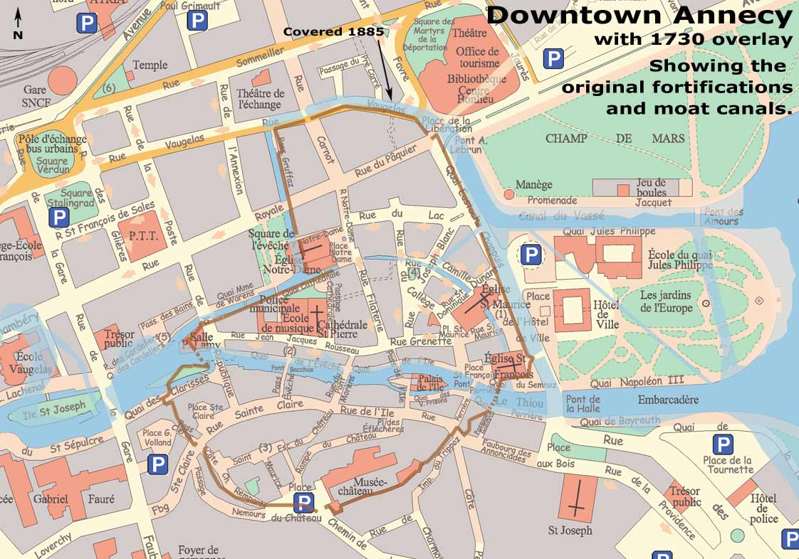 | 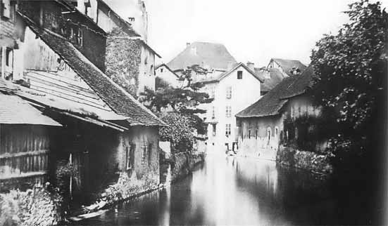 | 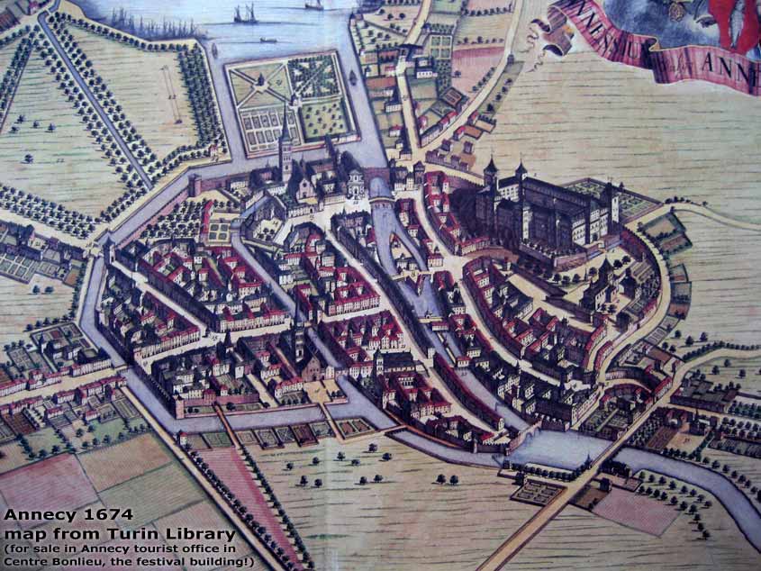 |
With the coming of christianity, it became a town along the Thiou river, with the island a toll crossing. In the middle ages, it was fortified (see the 1674 map on right), with two canals dug as moat, partly covered up in 1885: the middle image shows the entrance of the now Rue Vaugelas - a person silhouetted in the background is where the entrance to the square with the "Scottish Bar" (Le Chardon des Ecosses, with its 11 Euro Heineken pints) is!
The local mini London Bridge called Pont Morens (where the Captain Pub is) had its houses removed in 1886.
Interesting, huh? I mean - that everything relates to pubs...
Labels: Ponderings
posted by Hans Perk at 4:00 AM
![]()
![]()

0 Comments:
Post a Comment
<< Home